Thursday, August 30, 2018

Alice Springs - Uluru


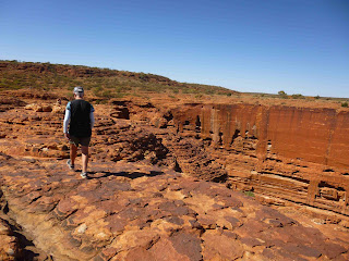
Mon 20 Aug – We left Alice Springs and headed east to the East MacDonnell Ranges for 80kms to Trephina Gorge. Some of the road was a “black top” (one sealed strip down the middle with red gravel either side) You put the left-hand wheels in the gravel when you meet an oncoming vehicle. The last 5kms was just gravel. The journey was worth it as we ended up in a great camp under the red cliffs of the gorge. In the afternoon we walked a 2km track up along the rim of the gorge to the far end and then returning thru the sandy centre of the gorge. Great views.


Tues 21 Aug – 2C inside “Andy” when we woke but very quickly warmed in the sun and we ended up having our porridge outside. We biked thru the other camps in this gorge before riding to the largest ghost gum tree in Australia, 30m high. In the afternoon we walked the second walk in the gorge, 2.5kms up a track for fantastic views in every direction. Back down into another dry river valley and then into the main gorge and back to “Andy”. In the evening we watched the sun set on the cliffs while having a drink and a chat to 3 other couples. A dingo slunk around us. After dinner we joined them again around a camp fire and swapped travelling tales.


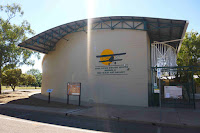
Wed 22 Aug – We drove back to Alice Springs for the last time and stocked up for the next part of our trip. Our overnight camp was in the back of a transport museum (a bit of a junk yard)  just out of town. Val spent some time booking our camps at Kings Canyon and Uluru. We had drinks with the couple next door. It is great to share tips with these folks.

Thurs 23 Aug – A 157km drive south on the Stuart Highway to a rest area at Desert Oaks. A pleasant enough place but a cool wind got up and blew red dust around. Every surface in “Andy” was covered in it! The country south of Alice Springs was quite different. Gone were the flat scrub cover desert replace by an undulating landscape with red rocky ridges.

Fri 24 Aug – We carried on south and at Erldunda we fuelled up and turned west off the Stuart Highway for our trip in to Kings Canyon and Uluru. Most people think that Uluru (Ayers Rock) is close to Alice Springs however it is a 463km drive S.W. Before visiting Uluru, we are going into Kings Canyon, and turned off the Uluru road after 100km and headed north for 60kms to a rest area at Salt Creek. We were the only ones their until about 6:00pm. We were getting a bit worried but eventually we were joined by about 6 other groups. Always safety in numbers!


Sat 25 Aug – 150km drive brought us into the Watarrka National Park and Kings Canyon. There is no camping in this park, so we stopped in the carpark and had a short walk into the canyon. Very pretty with the ghost gums and the red walls of the canyon towering above. After lunch we set off for a 4km walk up one side of the canyon and then onto a track thru some very unusual rock formations. Tomorrow we will walk the longer Kings Canyon Rim walk. Our overnight camp is at a Resort 6kms from the canyon. At sunset we walked up to a viewing area overlooking the back of Kings Canyon.


Sun 26 Aug – We left the resort and drove back to Kings Canyon, packed our lunch and set off on the Rim Walk. The first part was a steep climb out of the canyon on the north side, onto the rim where we followed around the red sandstone formations with views into the canyon and the south wall. We took a couple of detours for better views. Some stairs led into the Garden of Eden, an area of vegetation in a valley surrounded by the red rocks with a pool at the far end. Around the end of the canyon and then along the south wall with views of the north wall. All very spectacular. After lunch under the shade of a gum tree, we descended off the south rim and back to “Andy” for a cup of tea and a rest. A total of 8kms walk. Really great. We drove 120kms south back to Friday’s camp at Salt Creek.


Mon 27 Aug – Just a short drive of 103kms to a free camp at Curtain Springs. The first part of the drive was on the Kings Canyon road and then we turned west onto the highway to Uluru. We sat in the shade of a tree as the camp filled up.

Tues 28 Aug – Our 47th wedding anniversary. Val made pancakes for breakfast before another short drive west to Yulara. This town is the tourist and service centre for Uluru (Ayers Rock) as Uluru and Kata Tjuta are in a national park with no accommodation. We camped in the very expensive camping ground and then walked to the town square and the supermarket for a few supplies. We have booked an evening at the “Field of Lights” and were picked up in a coach and taken to a hill overlooking Uluru as the sun set. Hostesses supplied beer and champagne and “Aussie Canapes” (Kangaroo, Crocodile and Prawn). All very nice. The sunset was not as spectacular as we had hoped for but as it got darker the land in front of us began to glow with the lights of an art installation. There were 50,000 hand blown globes lit by fibre optic strings. The lights gradually changed colour. It looked like a huge Aboriginal dot painting in the desert. When it was really dark and the stars were out, we left the hill and wandered thru the lights. Beautiful.


Wed 29 Aug – We drove the 18kms to a carpark very near Uluru stopping on the way to purchase our 3 day entry fee ($25 p/p). After a short walk to find the Uluru Base track we decided to bike the 10.5kms around this huge orange rock. What a ride! There were many stops for photos and to walk into several gorges and waterholes. Some of the areas are sacred and photos were not allowed. We thought at some stage on our ride, that we could ride back in the other direction but the strong wind put us off this idea. Climbing the rock is highly discouraged for cultural reasons but we were surprised how many locals were hell bent to climb. We had no intention to climb but would have been out of luck as a strong wind got up and the climbing was closed. We went to the cultural centre but Aboriginal art does nothing for us. Back to “Andy” and the wind was really howling with dust blowing everywhere.


Thurs 30 Aug – On the road early for our visit to Kata Tjuta (The Olgas). This is another series of monoliths 50kms west of Uluru. If Urulu looks a bit like a loaf of bread, Kata Tjuta is like a batch of odd shaped scones. Kata Tjuta means many heads. After a photo stop at a viewing area we drove to the start of the Valley of Wind track.

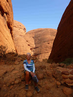
 Because there are valleys and gorges thru the rocks we followed an 8kms track thru spectacular scenery with towering rock formations all around us. Because of these valleys, we thought in some ways Kata Tjuta is more spectacular than Urulu. We drove back to Yulara and fuelled up before heading east for 160kms and an overnight stop at a rest area.


Sunday, August 19, 2018

Mt Isa - The Red Centre


Sun 5 Aug – We left the workers camp at the mine dominated Mt Isa and drove 180kms on flat highway to the only town in this area, Camooweal. Just out of the town we camped beside the Georgia River which, in the dry season is only a billabong. Quite a few camping here. It was another great spot.


Mon 6 Aug – The wind got up in the night and turned from a hot N/W to a cool S/E. We headed across the Northern Territory border and with a strong wind pushing us along, to Soudan Bore. We felt sorry for the caravans and campers going the other direction struggling into the wind. Our time will come at some stage however!  Behind another rest area for the night with lots of flies annoying us.

Tues 7 Aug – A fly free breakfast and then a shorter drive to Barkly Homestead, the only bit of civilization on the road. We fuelled up and got a camp site. Our cellphone lit up with texts as Mary, Val’s mum, had been admitted to hospital with a broken collar bone. Val rang the girls, Lynne and Alan. 4:00pm was “happy hour” in the bar and we enjoyed the live music and a chat with a couple going in the other direction. We went back to the restaurant and had a great pizza and chips sitting and chatting to another couple.

Wed 8 Aug – Overnight the camp had filled up. We were one of the last to leave as we only had a 117km drive to our camp at 41 Mile Bore. We found a site well off the road, but it was windy and a bit dusty. It took a couple of tries to get out of the wind and dust. Again, there were lots of flies but at Barkly Homestead we had bought hat nets. Judy and Frank had suggested these to combat the annoying problem. They look a bit strange (we look like bee keepers) but work well. Another beautiful sunset.

Thurs 9 Aug – It is hard to get our heads around the isolation of this part of the Northern Territory. Since leaving Camooweal we have travelled about 500kms with the only sign of civilization being Barkly Homestead. We came to a major milestone in our trip at Three Ways. This is the junction of the highway we have been travelling west with the Stuart Highway. Turn left and you eventually get to Adelaide and turn right and you get to Darwin. We turned left. 20kms down the road is Tennant Creek.
We had been advised by many of our follow travellers to go straight thru the town but we chose to stay in a camp here. This is very much an Aboriginal town. We walked about 1.5kms to the main street to shop. We were the only non-Aboriginal people around. We felt quite safe though but certainly not welcomed.


Fri 10 Aug – Out on the Stuart Highway
heading south for 110kms and then a short trip off the highway to an area called the Devil’s Marbles or Karlu Karlu. What a great place! We pulled into the camping area with huge red boulders all around. We did a short walk thru the rocky outcrops
before lunch and when it cooled down a bit we did a longer walk (5kms) around the whole area. This was a granite area and over time erosion has formed these unusual rocky outcrops many of which are almost perfect spheres. It reminded us of the Valley of Fire State Park in Nevada. In the evening we joined two couples around a camp fire.


Sat 11 Aug – The wind got up about 5:00am and blew hard. We stayed for it to calm down and did another 1.5km walk thru these amazing rock formations. Only a short drive today but the wind had eased. We stopped at an old WW11 army staging area. This was the first stop for the recruits on their way from Alice Springs to Darwin. Only the concrete foundations were left but they made great parking places out of the red dust. We relaxed but the flies were bad and we wore our hat nets. We both had haircuts today. We discovered later that is was the area where Peter Falconio, the British Tourist, was murdered!

Sun 12 Aug – Less wind this morning and a 150km drive.  At Barrow Creek Pub we bought $40 worth of fuel ($1.94/Lt)!!! and continued to Ti Tree where we topped the fuel up and had cell phone coverage so checked up on how Mary was. All good. Stopped for the night at another great rest area on the highway, Prowse Gap. Had a great chat to Rosie who is travelling by herself towing a caravan. She gave us a bottle of red wine which she does not drink. We have met lots of interesting characters at our O/N stops.

Mon 13 Aug – We drove on to Alice Springs which is situated in a valley. We booked into a camp for 2 nights. In the afternoon we biked into the CBD. The town has been recently rebuilt with some modern buildings and a great pedestrian area. The town is on the banks of the Todd River which is dry for 90% of the time. This weekend they are having the Henley on Todd regatta which is all nautically based in the dry river bed. Bizarre!


Tues 14 Aug – We spent some time cleaning the red dust which has got everywhere. A short ride to Bunnings to buy stuff to put a curtain over the window in the “Andy’s” door. We thought the window was not see thru but after some further investigation we have discovered that you can see in. We apologise to any Aussies we may have traumatised over the last few months. In the afternoon we biked 15kms along the great cycleways around the town ending up back in the CBD for a gelato before climbing ANZAC Hill, at one end of the town, for great views. Alice Springs is a very nice town, an oasis in the red centre of Aussie.

Wed 15 Aug – After a shop (with no alcohol however as in Northern Territory the bottle shops do not open until 2:00pm to stop Indigenous drunkenness at least until after lunch) and a fuel up, we headed off the Stuart Highway and inland into the West MacDonnell Ranges to Standley Chasm. We walked up to the chasm straight away as the sun only shines there for 90 minutes around midday. Very much like the slot canyons we had experienced in the USA. Quite spectacular. We will camp here the night, so later in the afternoon we walked the 1.2kms back to the chasm and then climbed out of the gorge up a steep natural stairway for magnificent views of the gorge and the chasm far below. Quite a climb.


Thurs 16 Aug – Back on the road west for 100kms into the McDonnell Ranges to the Ormiston Gorge. We found a nice flat campsite and took a quick walk to the waterhole. This is a spectacular body of water in the dry river bed. After lunch we followed the Gum Ghost trail out of the gorge to a great viewing platform with the waterhole below and then carried on back down into the gorge following the dry river bed back to the waterhole and our campsite.


Fri 17 Aug – After breakfast we packed our lunch and set off on the 7km Pound Trail. It was a great walk climbing into the hills for spectacular views of the red rocky hills and then down into the pound (the river valley) where we stopped for lunch. The trail eventually led into the Ormiston Gorge and it was hard work walking either in loose sand or boulder hopping back to the waterhole and “Andy”. It was a great walk but we were both fairly tired at the end. We spent the rest of the day relaxing at camp. There is a 230km trail (The Larapinta Trail) which follows the McDonnell Range from Alice Springs to Red Bank in 10 stages. Many of the people in the camps are following this trail.


Sat 18 Aug – Just a short drive of 45kms east to our next camp at Ellery Creek Big Hole. This is another beautiful body of water in another dry river bed surrounded by red cliffs. Before lunch we walked a 3km trail (The Dolomite Trail). Very nice but not as great as yesterday’s walk. We took our chairs down to the waterhole and enjoyed the changing light on the rocks and the water.

Sun 19 Aug – I have not mentioned the weather as it has been the same for as long as we can remember. Cool in the mornings (around 2-5C) but warming up very quickly to around 27-29C, breakfast outside most mornings, and cooling once the sun sets with very clear starry nights. This morning it was a bit different as a cool breeze kept the day temp to around 20C.  We drove back towards Alice Springs and stopped off at Desert Park, a wildlife experience of desert life. There were birds, marsupials, reptiles and mammals. All very interesting, we especially liked the nocturnal section, amazing what is wandering around the desert at night! Back into Alice Springs and another attempt at buying alcohol. Eventually I had to show my passport before being allowed to purchase expensive wine and beer. Stocked up so we will not have the problem again in the N.T. We are in a camp for the night and will drive into the Eastern MacDonnell ranges tomorrow for a few days and then resume our trip south on the Stuart Highway.


Saturday, August 4, 2018

Rockhampton - Mount Isa


Mon 23 July – Rockhampton is on both sides of the Fitzroy River
and was the first major port in this part of Central Queensland. We biked across the river on one of the three bridges into the CBD.
We walked the town which has many lovely old colonial buildings and then biked along the river bank.

Tues 24 July – Today we explored the other side of Fitzroy River
cycling to a huge mall where we bought some extra clothes before we head into the outback. We also bought a large fresh water jerry can, (you can never have enough water in the interior) a handheld CB radio, (trucks like to warn you as they pass) and Shoo Roos. (whistles that attach to your bumper bar to scare away the kangaroos supposedly!) All now set for the next part of our trip. After lunch we cycled into Kershaw Botanical Gardens where there was a great waterfall.

Wed 25 July – We headed off on the Capricorn Highway west to eventually meet up with the Stuart Highway (Darwin to Adelaide road through the centre). We will take about 2 ½ weeks for this trip a distance of 2000kms! Today’s trip was into the coal fields. Our lunch stop was at Bluff where they assemble the huge coal trains (2kms long) heading east. After 200kms we stopped at Blackwater and stayed at the Show Grounds.

Thurs 26 July – Another very pleasant drive on basically flat roads to our first stop at Emerald. There is a river here and the land is green thus the name. There was the largest painting on an easel in the world here. (Vincent Van Gogh’s Sunflowers).  Amazing what small towns do to attract visitors! We continued to Sapphire. The town was named after the sapphires that were extracted here up until the 1980s. The town now relies on the tourists visiting the many gem shops and offering gem fossicking.


Fri 27 July – We sat outside for breakfast and were joined by Rainbow Lorikeets. Val was not too keen to share her cereal! 

The road climbed slowly up to the Great Divide and then became very flat with long straights. There are road signs with trivial pursuit questions to stop you going
to sleep. We stopped at a small town call Jericho on the banks of the Jordan River. All very biblical! There was even a statue of Joshua blowing his trumpet.


Sat 28 July – Just a short drive today to the town of Barcaldine where around the 1900s the Shearers went on strike leading to the formation of the Australian Labour Party. We are camped in yet another free camping area and biked into the town to see the history. These free camps are great. Generally, they are in a rest area where travellers have a pit stop but out the back are trees and shade and lots of space for overnighting.


Sun 29 July – It rained briefly last night. The first rain for 30 days.
Back on the long flat straights on the road to Longreach. 109kms with only one small town but hundreds of dead kangaroos. Because of the drought the kangaroos feed on the edge of the road and get cleaned up by the trucks. Quite an obstacle course to dodge around. We planned to shop in Longreach but the IGA was closed for the weekend, so we went to large dusty crowded rest area, just out of town, for the night. There was an emu and a family of brolgas, an Australian crane, wandering around the camp.

Mon 30 July – Back into Longreach to shop and then a short drive to a much better rest area with nice shade and fewer campers. The twilight is beautiful with great light, a multitude of wildlife and birds. Last night it was grey and pink galahs flying around in squawking packs, tonight it was strange grey sooty birds doing the same thing.


Tues 31 July – The country has become more barren with only low shrubs and yellow grass. Our plan was to stop before the town of Winton but the rest area was only small and not great. We continued on to Winton and found a great campsite down a dusty road on the shores of a small dam or billabong. We even camped under a small coolabah tree. “Andy” felt very at home! Slowly the camp filled up but was still beautiful. Great reflections on the billabong.


Wed 1 Aug – Back into Winton to dump, pick up water, fuel and LPG. We had a 165kms drive to a Road House at Kynuna (the only thing there apart from the pub). We are now about half way from Rockhampton to the east and the Stuart Highway to the west (1000kms away). The temperatures during the day are around 29C but still cool as soon as the sun sets. This was a hard case place with a tough old biddy running everything, cookhouse, camp ground and petrol station. Val did a load of laundry and it was great sitting in the shade watching the sunset.

Thurs 2 Aug – We have become aware of fuel so we topped up before heading on to Cloncurry -186kms. The landscape changes all the time and today we changed from barren grasslands back to red soil, bush, termite hills and cattle. Cloncurry is a real outback town based on cattle and some mining with a wide main street, a few pubs and very little else. We camped in a small camp just out of town and rode our bikes to the main attraction of the town, the Flying Doctor Museum. This was the birth place of the RFDS. It was very well done and interesting. I enjoyed the early pedal powered radios installed in the remote homesteads.

Fri 3 Aug – We have discovered that it is Cloncurry’s Rodeo Weekend with free admission to the rodeo today and a parade
tonight so we have decided to stay another day. We drove “Andy” to the rodeo as it was about 6kms out of town and arrived there about 12:30pm. It was a great
afternoon with calf roping, steer wrestling, Bronco riding and bull riding events. This is the highest paid rodeo in Australia (so they claim). It all ran very smoothly with one event straight after the other. They even had a big screen. Best rodeo we have ever been to. (only the Omarama rodeo to compere it to however). We drove back into town for the parade. A very typical small town event but well done.


Sat 4 Aug – Back on the road and into completely different country. The road to Mt Isa was thru hilly red rock terrain. Very much like lots of the USA we had driven thru.  Just before Mt Isa we stopped and climbed the Telstra hill for a great overview of the town and the mines. At the town we had a big shop up as from now on supplies will be limited. We were amazed that the town is totally dominated by the huge Mt Isa mine, casting its shadows from the chimneys into the main street. Obviously, the town just sprang up around the mine. This mine produces copper, lead and zinc. Our camp for the night is basically a worker’s camp with some caravan sites.